
Fil:Battle of Tory Island.svg

Størrelse for denne PNG-forhåndsvisningen av denne SVG-filen: 400 × 550 piksler Andre oppløsninger: 174 × 240 piksler | 349 × 480 piksler | 558 × 768 piksler | 745 × 1 024 piksler | 1 489 × 2 048 piksler.
Opprinnelig fil (SVG-fil, standardstørrelse 400 × 550 piksler, filstørrelse: 230 KB)
| Denne filen er fra Wikimedia Commons og kan brukes av andre prosjekter. Informasjonen fra filbeskrivelsessiden vises nedenfor. |
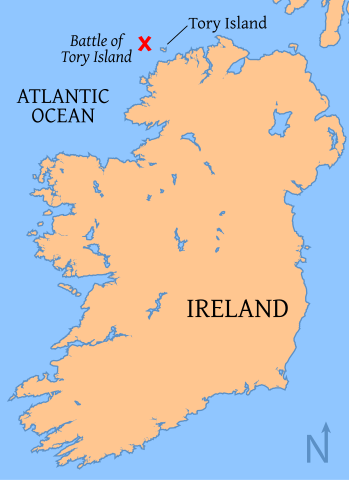
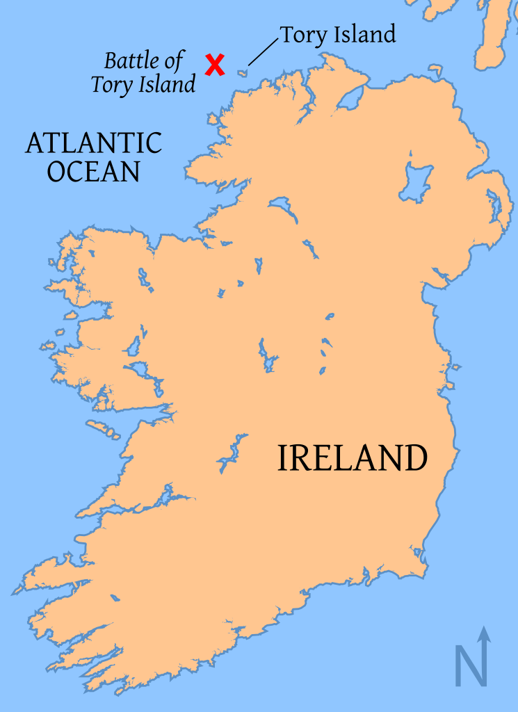
| Beskrivelse | Map of the location of the Battle of Tory Island, of the coast of County Donegal, Ireland map |
| Dato | |
| Kilde | Base map from OMC, modified by myself with the battle location from other versions. |
| Opphavsperson | Tkgd2007 |
| Tillatelse (Gjenbruk av denne filen) |
GFDL |
| Andre versjoner | Image:Battle of Tory Island.png, Image:Battle of tory island location.png |

|
Det tillates at dette dokumentet kopieres, distribueres og/eller modifiseres under retningslinjene som beskrevet i GNU fri dokumentasjonslisens, versjon 1.2 eller senere utgave utgitt av Free Software Foundation; med alle seksjoner, uten noen forsidetekster og baksidetekster. En kopi av lisensen er inkludert i avsnittet GNU Free Documentation License. |
| Denne filen er lisensiert under lisensen Creative Commons Navngivelse-DelPåSammeVilkår 3.0 Unported | ||
| ||
| Dette lisensmerket ble lagt til filen som del av lisensoppdateringen av GFDL. |
Filhistorikk
Klikk på et tidspunkt for å vise filen slik den var på det tidspunktet.
| Dato/klokkeslett | Miniatyrbilde | Dimensjoner | Bruker | Kommentar | |
|---|---|---|---|---|---|
| nåværende | 17. jul. 2008 kl. 03:10 | | 400 × 550 (230 KB) | Tkgd2007 | {{Information |Description=Map of the location of the Battle of Tory Island, of the coast of County Donegal, Ireland map |Source= Base map from [http://www.aquarius.geomar.de/omc/make_map.html OMC], modified by myself with the battle location from other |
Filbruk
Den følgende siden bruker denne filen:
Global filbruk
Følgende andre wikier bruker denne filen:
- Bruk i de.wikipedia.org
- Bruk i en.wikipedia.org
- Bruk i ga.wikipedia.org
- Bruk i it.wikipedia.org
- Bruk i ja.wikipedia.org