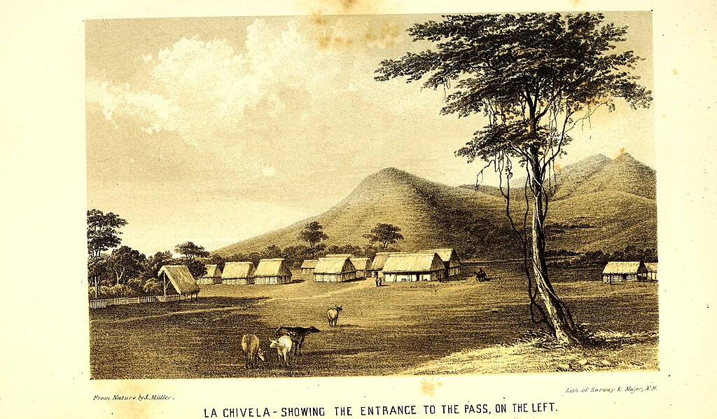
Fil:The Isthmus of Tehuantepec - being the results of a survey for a railroad to connect the Atlantic and Pacific oceans, made by the scientific commission under the direction of Major J.G. Barnard - with (14760311115).jpg

Sideinnholdet støttes ikke på andre språk.
Fra Wikipedia, den frie encyklopedi

Opprinnelig fil(4 240 × 2 476 piksler, filstørrelse: 2,01 MB, MIME-type: image/jpeg)


Wikimedia Commons' logo

Beskrivelse

Beskrivelse
English:

Identifier: isthmusoftehuant00will (find matches)
Title: The Isthmus of Tehuantepec : being the results of a survey for a railroad to connect the Atlantic and Pacific oceans, made by the scientific commission under the direction of Major J.G. Barnard ... : with a résumé of the geology, climate, local geography, productive industry, fauna and flora, of that region : illustrated with numerous maps and engravings
Year: 1852 (1850s)
Authors: Williams, John Jay, 1818-1904 Tehuantepec Railroad Company United States Naval Observatory, former owner. DSI
Subjects: Railroads
Publisher: New York : D. Appleton & Company ...
Contributing Library: Smithsonian Libraries
Digitizing Sponsor: Biodiversity Heritage Library

View Book Page: Book Viewer
About This Book: Catalog Entry
View All Images: All Images From Book
Click here to view book online to see this illustration in context in a browseable online version of this book.

Text Appearing Before Image:
y ar-rested by the Pio Almoloya. This range forms the southwesternlimit of what are termed the plains of Xochiapa. From the summit of Nisi Conejo the line continues in a south-easterly direction, descending on a grade of sixty feet to themile, to the level of the plains of Chivela;. thence it continues itscourse to the Hacienda of that name at the entrance of ChivelaPass. The entrance from these plains to the Pass of Masahua is threemiles distant, from a point 2000 feet north of the Hacienda,and bears S. 74° E. From this initial point the line ascends thevalley of a stream winding among the bare hills, on a generaldirection a little east of south, nearly one mile and three-quartersto the summit, which is 125 feet above the plains of Chivela; 115feet above the bench mark at the Hacienda of that name, and843 feet above the Pacific Ocean. Here it is proposed to makea thorough cut of about 2500 feet, with an average depth of40 feet, the grade line at the deepest point being 63 feet below
Text Appearing After Image:
ENGINEERING EEPOBTS. 27 the surface. This would reduce the summit at grade to only,60 feet above the plains of Chivela, and 793 feet above thePacific. From the surface indications, there is reason to believe that thematerial in this cut will be found almost entirely composed oftalcose and clay slates—rocks which generally disintegrate onexposure to the atmosphere, and are very easily blasted in theirmore solid state. It is very probable that from five to twentyfeet of the surface can be readily removed with the pick andshovel—the remainder by blasting. Descending from the summit on a sixty-feet grade, the gen-eral course of the line is nearly south, and continues on theright of the valley of the Summit Arroyo, till it reaches DantaPass, where the valley opens between the ends of two highmountains into that of the Torrente de Masahua Themountain on the right is called Masahuita / that on the left, Cerro de Espinosa From the summit to Masahuita, we encounter a succession ofridges or

Note About Images

Please note that these images are extracted from scanned page images that may have been digitally enhanced for readability - coloration and appearance of these illustrations may not perfectly resemble the original work.
Dato
Kilde

https://www.flickr.com/photos/internetarchivebookimages/14760311115/

Opphavsperson Internet Archive Book Images
Tillatelse
(Gjenbruk av denne filen)
At the time of upload, the image license was automatically confirmed using the Flickr API. For more information see Flickr API detail.
Flickr tags
InfoField
Flickr posted date
InfoField
27. juli 2014


Lisensiering

This image was taken from Flickr's The Commons. The uploading organization may have various reasons for determining that no known copyright restrictions exist, such as:
  1. The copyright is in the public domain because it has expired;
  2. The copyright was injected into the public domain for other reasons, such as failure to adhere to required formalities or conditions;
  3. The institution owns the copyright but is not interested in exercising control; or
  4. The institution has legal rights sufficient to authorize others to use the work without restrictions.

More information can be found at https://flickr.com/commons/usage/.


Please add additional copyright tags to this image if more specific information about copyright status can be determined. See Commons:Licensing for more information.
Dette bildet ble opprinnelig lastet opp til Flickr av Internet Archive Book Images på https://flickr.com/photos/126377022@N07/14760311115. Det ble undersøkt av boten FlickreviewR den 2. oktober 2015 og bekreftet å være lisensiert under vilkårene til No known copyright restrictions.

2. oktober 2015

Bildetekster

Legg til en kort forklaring på hva filen representerer

Elementer som er med i denne fila

motiv

image/jpeg

Filhistorikk

Klikk på et tidspunkt for å vise filen slik den var på det tidspunktet.

Dato/klokkeslettMiniatyrbildeDimensjonerBrukerKommentar
nåværende12. okt. 2022 kl. 16:50Miniatyrbilde av versjonen fra 12. okt. 2022 kl. 16:504 240 × 2 476 (2,01 MB)SteinsplitterBotBot: Image rotated by 90°
2. okt. 2015 kl. 07:36Miniatyrbilde av versjonen fra 2. okt. 2015 kl. 07:362 476 × 4 242 (2,02 MB)== {{int:filedesc}} == {{information |description={{en|1=<br> '''Identifier''': isthmusoftehuant00will ([https://commons.wikimedia.org/w/index.php?title=Special%3ASearch&profile=default&fulltext=Search&search=insource%3A%2Fisthmusoftehuant00will%2F fin...

Den følgende siden bruker denne filen:

Global filbruk

Følgende andre wikier bruker denne filen: